KU students wrap up course in aerial mapping using drones
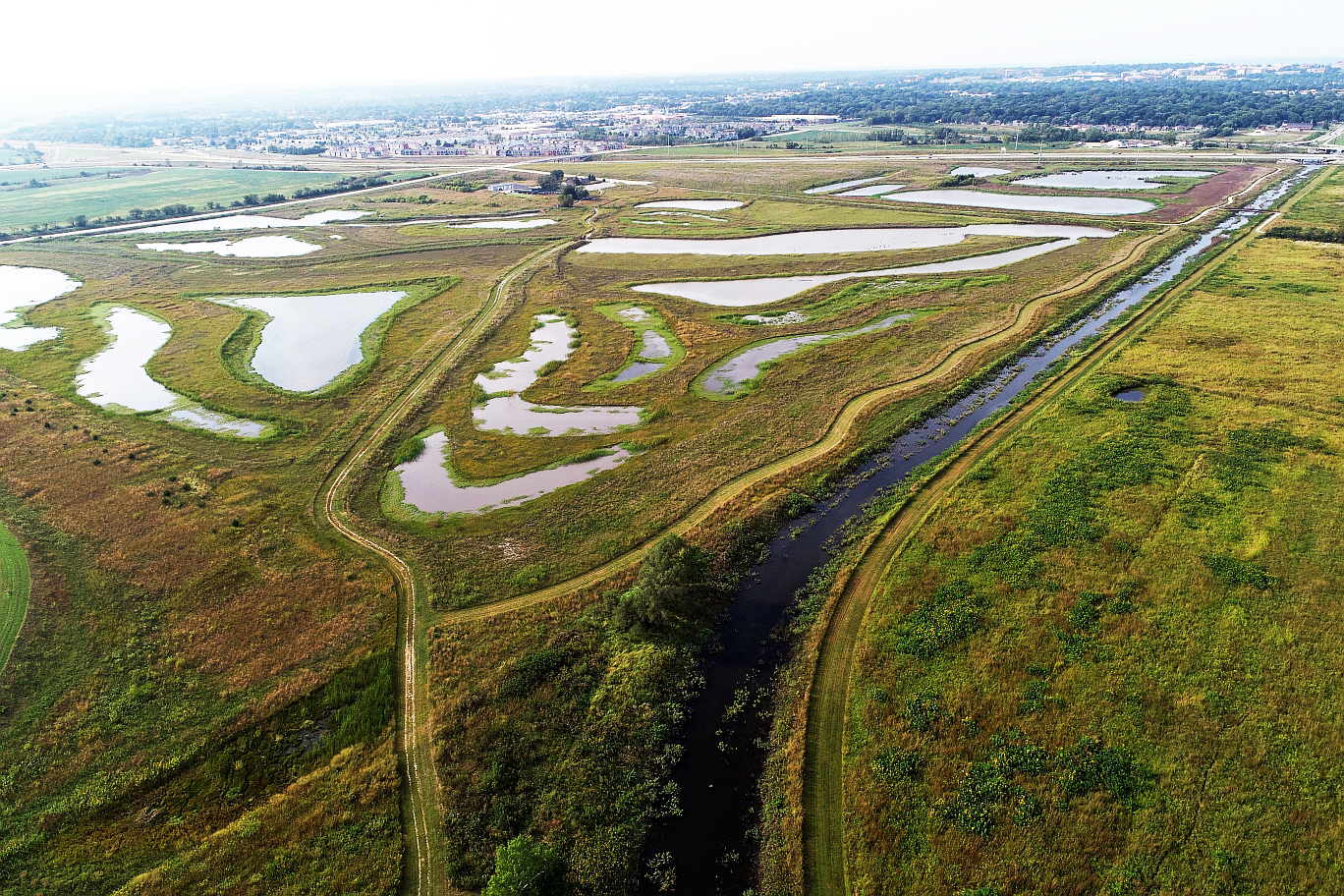
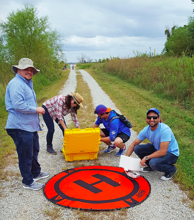
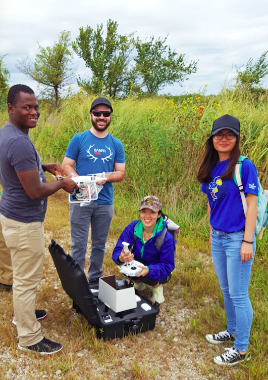
LAWRENCE — Fall break is barely behind us, but a group of University of Kansas students has just finished an innovative eight-week course in using drones to develop aerial maps. Over the past two months, they’ve visited sites in KU's West District and at the Baker Wetlands, taking still images and videos over those areas.
“The drone mapping course has been excellent in providing a hands-on experience with the drones,” said Siddharth Shankar, graduate student from Lucknow, India. “The course has focused not just on drones and how to fly them but also has made us aware of the FAA rules and regulations about drone flying and safety precautions.
“My research has been in glaciology, with the study of icebergs in Greenland. The drone mapping course has provided new insights into incorporating it with my research in the near future.”
 The course, offered annually during the fall semester, is designed to teach students about the rapidly growing technology of small unmanned aerial systems, referred to as drones, and its wide-ranging applications — which include search-and-rescue, real estate and environmental monitoring.
Students in the course come from a variety of disciplines including geography & atmospheric science, geology, ecology & evolutionary biology and civil engineering. Enthusiasm for the course has been very high, and it has filled rapidly each time it has been offered.
Three scientists, all holding the FAA Remote Pilot Certificate, teach the course:
- Dana Peterson, a Kansas Biological Survey researcher with a doctorate in geography
- Steve Egbert, who will soon retire as professor of geography and senior scientist at the Biological Survey
- Xingong Li, professor of geography & atmospheric science.
 “The drone industry has been increasing nearly exponentially,” Egbert said. “Drone applications, including using drones for mapping and environmental monitoring, are becoming more and more commonplace. Students who gain experience piloting drones, collecting aerial photography and creating digital maps in the lab will have an advantage not only with their own research but when it comes time to enter the job market.”
Drone imagery captured in the course can be combined with other available data for student‐led research. Likewise, the drone data captured will enhance current research and provide opportunities for future research collaborations. The course is open to both undergraduate and graduate students.
The course is a component of the KansasView program, part of the U.S. Geological Survey’s AmericaView, a national consortium of scientists who use Landsat and other satellite data to promote remote sensing education and outreach.
Within the AmericaView program, each state’s goals and activities are different, with KansasView currently focused on drones for aerial mapping applications. Primary funding for KansasView comes from a USGS grant. Egbert initiated the grant for the program in 2004; Peterson will lead the program going forward.
KansasView has a consortium, including the Kansas GIS Policy Board, the Data Access and Support Center at the Kansas Geological Survey, the KU Edwards Campus, Kansas State University, Fort Hays State University, Emporia State University and Haskell Indian Nations University. It also works closely with a number of state agencies.
The program has provided research scholarships to its partner educational institutions, sponsored a statewide remote sensing conference, co‐sponsored events with other state agencies and nonprofits, and presented at local and regional conferences and meetings.
In addition, Egbert has mentored undergraduates in KU’s federally funded Post-Baccalaureate Research Education Program, which provides experiences and training to assist recently graduated students, particularly those from groups underrepresented in biomedical and behavioral research, to prepare for graduate school in a science-related field.
Students in the class:
- Christine Chan, San Diego graduate student in geology
- Natasha Chenot, Lawrence graduate student in geography
- Ben Freeman, Greenville, Liberia, graduate student in ecology and evolutionary biology
- Raffi Hatutian, Leawood senior in geography and environmental studies
- Andrew Hoxey, Lawrence, graduate student in geology
- Chen Liang, Tianjin, China, graduate student geography
- Michael Shahin, Rock Hill, South Carolina, graduate student in geology
- Siddarth Shankar, Lucknow, India, graduate student in geology
- Nicholas Shea, Columbus, Indiana, graduate student in geography
- Kiera Smith, Overland Park, graduate student in geography
- Christopher Solso, Pismo Beach, California, junior in geography and communication studies
- Ian Thompson, Pittsburgh, Pennsylvania, graduate student in geology
- Wenjun Yang, Zhangjiakou, Hebei province, China, graduate student in geography
The Kansas Biological Survey, a KU designated research center, was established at KU in 1911. It houses a variety of environmental research labs and remote sensing/GIS programs in Takeru Higuchi Hall and the West District greenhouse. It also manages the 3,700-acre KU Field Station, a site for study in the sciences, arts and humanities.