KU researchers launch new Kansas ecosystems online teaching tool
LAWRENCE — Dana Peterson hopes the new ArcGIS StoryMap Mapping Kansas Ecosystems will draw attention to the wide range of landscapes across the state — and serve as an online resource in classrooms, libraries and homes, for all ages.
“Here in northeastern Kansas, we think of one landscape: green, hilly, a mix of woodland and grassland,” said Peterson, an assistant research professor focused on remote sensing at the Kansas Biological Survey & Center for Ecological Research. “But Kansas has incredible variety of different grassland ecosystems, and different types of woodlands and wetlands, some native and others human-created. This StoryMap provides a great entry point to these ecosystems.”
 Peterson and research colleague Jennifer Moody created the extensive website using the StoryMap multimedia platform. Through a mix of photos, videos, conversational text, history and interactive maps, the site dives deep into the modern landscape and the “ecosystem influencers” that shape it. An embedded web application, Kansas Ecological Systems Map and Field Sites, enables users to explore 49 mapped land cover types.
Completed in September, the website grew out of a larger, five-year project: the development of a new Kansas land cover map — focused on non-cropland. While the land cover map does include a cropland class, the project group’s goal, Peterson said, was to understand non-cropland vegetation systems, whether native or “messy” classes that occur as the result of human impacts.
“There isn’t a lot of attention placed on understanding what land cover is and what it means, and how crucial this information is to conservation decisions,” Peterson said. “The StoryMap goes into what factors drive land cover and land use — whether natural factors, such as the state’s east-west precipitation gradient, or human use including habitat fragmentation.”
To develop the land cover map, Peterson and other researchers at the Kansas Biological Survey & Center for Ecological Research traveled throughout the state, collecting data and taking photos. The group included Moody and former researchers Courtney Masterson and Amy Isenburg. Kelly Kindscher, a senior scientist at the research center and a KU professor in the Environmental Studies Program, created the Kansas plant community classification and also directed and participated in the project’s field research.
To showcase the land cover map and provide public educational content about Kansas landscapes, Peterson secured a one-year grant for the StoryMap from AmericaView, a nationwide network focused on using public domain satellite/remote sensing imagery for education, applied research and technology transfer. The network of university-based members, representing 41 states, is supported by the U.S. Geological Survey. Peterson is the lead investigator and coordinator for KansasView, the member in this state.
The land cover map is a collaboration between the Kansas Biological Survey & Center for Ecological Research and the Missouri Resource Assessment Partnership (MoRAP). The Kansas Department of Wildlife and Parks and the Nebraska Department of Natural Resources provided funding for the development of land cover maps for both states in tandem. All project partners worked in tight coordination to create new maps with borders that would match seamlessly.
The Kansas Biological Survey & Center for Ecological Research houses a diverse group of ecological research and remote sensing/GIS programs at KU. It also manages the 3,700-acre KU Field Station, a resource for study across the university.
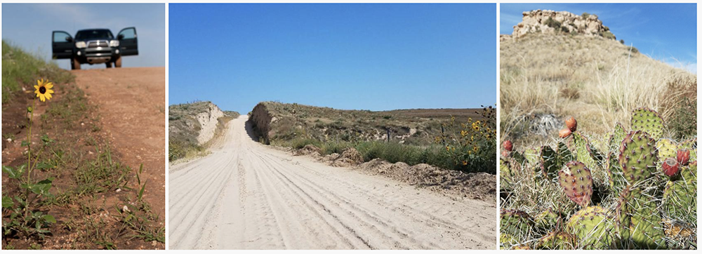
Top image: A variety of landscapes shown in the new ArcGIS StoryMap Mapping Kansas Ecosystems.
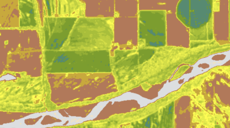
Right image: A map of vegetation cover along the Kansas River near Lakeview Lake oxbow.