From abandoned coal mines to war zones, Kansas Geological Survey technology reveals underground threats
LAWRENCE — At the Kansas Geological Survey (KGS), a hazard detection program begun nearly 40 years ago to detect abandoned coal mines in southeast Kansas will enter a new era of artificial intelligence, neural networks and machine learning, supported in part by a $15 million grant from the U.S. Army Engineer Research and Development Center.
The new funds continue decades of Army support for technology and techniques developed by the KGS’ Geophysics Applications and Field Services unit using seismic imaging hardware and software systems to identify underground threats — sinkholes, abandoned mines, contaminant transport pathways — that could endanger public safety.
The KGS team began its work in the 1980s to address the problem of unmapped and abandoned mines in the Pittsburg, Galena, Treece, Baxter Springs and Columbus areas in southeast Kansas, where the coal, lead and zinc mining industries thrived for a hundred years beginning in the late 1880s.
Though most mine operations ended decades ago, hidden threats remain. A study in the 1980s identified nearly 600 mine hazards in and around Galena. In 2009, a building housing a group of apartments and a bar partially collapsed after the ceiling of a mine under the town gave way.
“We had a public safety problem in Kansas, we focused our work to try to solve it, and because of the Army’s interest in applying our solution to their problems, the military has spent millions on our ideas,” said Rick Miller, who leads the KGS Geophysics Applications and Field Services program. “That, in turn, has resulted in monumental successes for national security at the U.S.-Mexico border and overseas for the military and, most importantly, here at home for the people of Kansas.”
The techniques developed by Miller and his team have been used to monitor trouble spots across the state — from the mining area in southeast Kansas to central Kansas, where voids resulting from the dissolution of underground salt beds could lead to the development of sinkholes.
"Other examples include contaminant transport through shallow fractures in limestone bedrock in eastern Kansas (the Olathe area in particular), abandoned underground limestone mines in eastern Kansas and abandoned hand-dug water wells and cisterns throughout Kansas, to name a few,” Miller said.
Applications beyond Kansas
But their applications expanded beyond Kansas borders when the Army saw the potential to use the technology in areas where underground voids present a risk to military operations or national security.
The Army, working with Border Patrol in the San Diego area, invited the KGS to test whether the technology could effectively detect known tunnels used to illegally move people and drugs from Mexico into the United States.
After proving its capabilities, the KGS began an expedited research effort with the Corps of Engineers to develop adaptations for new applications, especially along the U.S. border with Mexico. One of the covert tunnels the KGS team detected there, well in advance of human intelligence revealing its existence, has now been converted to a test site by U.S. Border Patrol.
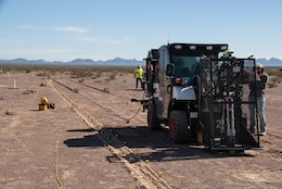
The Army, in collaboration with the KGS, developed another test site in Arizona designed to emulate targets known to be threats to U.S. interests around the world.
Benefits to the region
Capabilities developed for the Army through federally funded research are not just applicable to the military. They also significantly benefit Kansas and are relevant to subsurface hazards across the state.
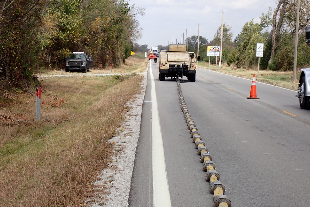
In southeast Kansas, for example, lead and zinc mines undercut the last mile of U.S. Highway 69 in Kansas before the Oklahoma border, raising concerns at the Kansas Department of Transportation that sinkholes could form and catastrophically damage the highway and, worst case, represent a threat to public safety. Every couple of years, the KGS conducts a survey near Treece to monitor conditions under the highway.
“We took all that technology and brought it right back and put it into play around communities like Treece, Galena, Pittsburg. We routinely work with KDOT around the state to address their various near-surface ground stability problems using a capability fully developed and funded from non-state dollars,” Miller said. “No other state has this kind of readiness to go out and look for these risks, to protect the citizens of the state and state resources.
“The two to three million dollars in equipment, all the research and development we’ve done — that’s all been funded by federal grants, and we now put it to use in Kansas to benefit public safety, infrastructure and the environment in a fashion not possible without the last two decades of collaboration with the U.S. Army.”
New techniques, new environments
The $15 million in new military funding will allow KGS to apply the technology to new geologic environments and develop computational techniques and methodologies to reduce the amount of technical expertise needed to analyze the data.
“We’re not trying to make the computer think like a person does,” Miller said of the move toward incorporating aspects of artificial intelligence and machine learning into the program. “We want to be able to train the computer with millions and millions of examples to reduce the iterations of trial and error and, therefore, reduce the time in route to the right answer.”
Success will mean speeding up the process of analyzing data to near real time.
“You can turn a computer loose on it. You don’t have to have a Ph.D. scientist here in the lab processing for weeks on end,” Miller said.
At the same time, Miller’s team will look to expand the effectiveness of the technology from loose sands and gravels to hard rock environments such as limestones and granites.
“The Army has long-term interest in being able to detect voids in limestone and granite,” Miller said. “And what we’re developing now will have a direct application to the harder rock environments of the lead and zinc mining region in southeast Kansas as well as the granite beneath the U.S.-Mexican border in the Nogales, Arizona, area, for example.”
In the coal mining area around Pittsburg, Scammon and Columbus in Kansas, the upper 30 feet of soil consists of soft sediments that respond to the techniques used by Miller’s team in ways similar to the sands and gravels in the desert environment initially of interest to the Army. But the harder rock environment of the lead and zinc mines — limestones and dolomites, with abundant fractures similar to granite — has been a very difficult area in which to work. The Army’s renewed interest in harder rock settings aligns with enhancing the potential of this method in those challenging settings in southeast Kansas.
This line of applied research is of great enough interest to the Army that the current funding commitment of up to $15 million has options for more than $8 million in additional funding extended over 10 years.
“In a lot of respects, it’s great for us,” Miller said of the new direction his research is taking. “Extending the KGS research into harder rock environments and computational intelligence is perfectly aligned with the focus, direction, and strategic vision of the KGS geophysics team and with the Army’s perceived needs for the future.”
About the Kansas Geological Survey
The KGS is a nonregulatory research and service division of the University of Kansas. KGS researchers study and provide information about the state’s geologic resources and hazards, including groundwater, oil and natural gas, critical materials and earthquakes.